| Head west on Via N. Melchiori | 200 m |
| Turn left onto Via Paolo Piazza | 100 m |
| Turn right onto Via Piazza Paolo | 200 m |
| Make a sharp left onto Via Giacomo Matteotti | 400 m |
| Continue onto Borgo Padova | 250 m |
| Enter the traffic circle and take the 1st exit onto Borgo Padova | 5.5 m |
| Exit the traffic circle onto Borgo Padova | 400 m |
| Enter the traffic circle and take the 2nd exit onto Borgo Padova | 15 m |
| Exit the traffic circle onto Borgo Padova | 400 m |
| Enter the traffic circle and take the 2nd exit towards SR245: Venezia | 150 m |
| Exit the traffic circle towards SR245: Venezia | 800 m |
| Continue onto Via Castellana (SR245) | 1.5 km |
| Enter the traffic circle and take the 1st exit onto Via Castellana (SR245) | 25 m |
| Exit the traffic circle onto Via Castellana (SR245) | 1 km |
| Continue onto Via Roma (SR245) | 150 m |
| Keep left towards SR245: Piombino Dese | 300 m |
| Make a slight right towards SR245: Piombino Dese | 2 km |
| Enter the traffic circle and take the 2nd exit onto Corso Giovanni Stevanato (SR245) | 40 m |
| Exit the traffic circle onto Corso Giovanni Stevanato (SR245) | 1 km |
| Enter the traffic circle and take the 2nd exit onto Corso Giovanni Stevanato | 30 m |
| Exit the traffic circle onto Corso Giovanni Stevanato | 1 km |
| Enter the traffic circle and take the 2nd exit onto Corso Giovanni Stevanato (SR245) | 25 m |
| Exit the traffic circle onto Corso Giovanni Stevanato (SR245) | 550 m |
| Enter the traffic circle and take the 2nd exit towards Venezia | 70 m |
| Exit the traffic circle towards Venezia | 800 m |
| Enter the traffic circle and take the 2nd exit onto SR245 | 40 m |
| Exit the traffic circle onto SR245 | 2.5 km |
| Enter Via Castellana and take the 2nd exit onto Via Castellana (SR245) | 80 m |
| Exit the traffic circle onto Via Castellana (SR245) | 800 m |
| Continue onto Via Martiri della Libertà (SR245) | 500 m |
| Enter the traffic circle and take the 4th exit onto Via Venezia (SR245) | 60 m |
| Exit the traffic circle onto Via Venezia (SR245) | 800 m |
| Enter the traffic circle and take the 3rd exit onto Via Castellana (SR245) | 70 m |
| Exit the traffic circle onto Via Castellana (SR245) | 3 km |
| Enter the traffic circle and take the 1st exit onto Via Milano | 25 m |
| Exit the traffic circle onto Via Milano | 1 km |
| Enter the traffic circle and take the 2nd exit onto SR515 | 60 m |
| Exit the traffic circle onto SR515 | 1 km |
| Enter the traffic circle and take the 2nd exit onto SR515 | 60 m |
| Exit the traffic circle onto SR515 | 450 m |
| Enter the traffic circle and take the 2nd exit onto SR515 | 50 m |
| Exit the traffic circle onto SR515 | 1.5 km |
| Enter the traffic circle and take the 3rd exit onto Strada Regionale 245var Martellago-Scorzè (SR245var) | 100 m |
| Exit the traffic circle onto Strada Regionale 245var Martellago-Scorzè (SR245var) | 450 m |
| Enter the traffic circle and take the 1st exit onto Strada Regionale 245var Martellago-Scorzè (SR245var) | 30 m |
| Exit the traffic circle onto Strada Regionale 245var Martellago-Scorzè (SR245var) | 600 m |
| Enter the traffic circle and take the 2nd exit onto Strada Regionale 245var Martellago-Scorzè (SR245var) | 80 m |
| Exit the traffic circle onto Strada Regionale 245var Martellago-Scorzè (SR245var) | 1 km |
| Enter the traffic circle and take the 2nd exit towards A4: TRIESTE | 250 m |
| Exit the traffic circle towards A4: TRIESTE | 150 m |
| Continue towards A4: TRIESTE | 500 m |
| Merge left onto Autostrada Serenissima (A4) | 150 km |
| Continue onto Raccordo Autostradale 13 Sistiana-Padriciano (RA13) | 15 km |
| Take the ramp towards autoporto Fernetti | 1 km |
| Continue onto Raccordo Autostradale 14 (RA14) | 2 km |
| Continue onto A3 | 250 m |
| Go straight onto A3 | 10 km |
| Keep left towards A1: Ljubljana | 1.5 km |
| Merge left onto A1 | 60 km |
| Keep right towards A1: Gradec | 1 km |
| Continue onto Južna obvoznica (A1) | 8 km |
| Keep right towards A2: Zagreb | 100 km |
| Continue onto A3 | 300 km |
| Take the ramp | 550 m |
| Merge left onto A3 | 300 m |
| Turn right | 80 m |
| Turn left | 70 m |
| Take the ramp on the right | 450 m |
| Merge left onto A3 | 90 km |
| Keep left towards A 1: Sofia(BG) | 2.5 km |
| Merge right onto Обилазница око Београда (A1) | 30 km |
| Keep left towards A 1: Skopje | 200 km |
| Take the ramp towards A4: Sofia (BG) | 1.5 km |
| Continue onto A4 | 100 km |
| Continue onto Автомагистрала Европа (A 6) | 35 km |
| Keep left towards 8: Петърч | 15 km |
| Enter the traffic circle and take the 3rd exit towards Видин | 150 m |
| Exit the traffic circle towards Видин | 350 m |
| Take the ramp on the left towards Видин | 100 m |
| Merge left onto Околовръстен път (8) | 4 km |
| Take exit 49 towards А 6: Варна | 1 km |
| Merge left onto Автомагистрала Европа (A 6) | 15 km |
| Take exit 64 towards А 1: Пловдив | 1.5 km |
| Merge left onto Околовръстен път (1) | 8 km |
| Take the ramp towards A 1: Пловдив | 350 m |
| Merge left onto Автомагистрала Тракия (A 1) | 150 km |
| Keep right towards А 4: Свиленград | 100 km |
| Keep left towards Turkey | 500 m |
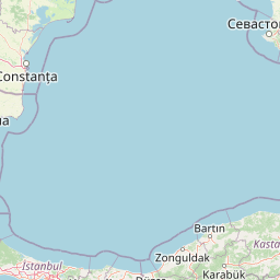
| Continue onto Kapıkule Sınır Kapısı (D-100) | 10 km |
| Keep left towards Lalapaşa | 150 km |
| Take exit K-1 towards O-7: Çatalca | 1 km |
| Keep left towards O-7: Çatalca | 2.5 km |
| Continue towards O-7: Çatalca | 100 km |
| Keep left onto Kuzey Marmara Otoyolu (O-7) | 4.5 km |
| Continue onto Viyadük-29 (O-7) | 600 m |
| Continue onto Kuzey Marmara Otoyolu (O-7) | 30 km |
| Keep left onto Kuzey Marmara Otoyolu (O-7) | 45 km |
| Keep left onto Kuzey Marmara Otoyolu (O-7) | 60 km |
| Merge left onto Anadolu Otoyolu (O-4) | 250 km |
| Take the ramp onto Akıncı Köprülü Kavşağı | 400 m |
| Keep left onto Akıncı Köprülü Kavşağı | 350 m |
| Keep right onto Akıncı Köprülü Kavşağı | 350 m |
| Go straight onto 06-75 | 500 m |
| Take the ramp on the right | 550 m |
| Merge left onto Fatih Sultan Mehmet Bulvarı (D750) | 30 km |
| Continue onto İstanbul Caddesi (D750) | 1 km |
| Keep left onto İstanbul Caddesi | 600 m |
| Keep left onto İstanbul Caddesi | 200 m |
| Continue onto İstiklal Caddesi | 450 m |
| Turn right onto Atatürk Bulvarı | 800 m |
| Make a slight right to stay on Atatürk Bulvarı | 150 m |
| Keep right onto Altınsoy Caddesi | 80 m |
| Turn left | 150 m |
| Go straight onto Celal Bayar Bulvarı | 200 m |
| You have arrived at your destination, on the right | 0 m |


 Log in with Google